


008 WAU Precinct, Knox County, Nebraska
About
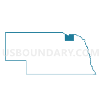
Outline

Summary
| Unique Area Identifier | 613338 |
| Name | 008 WAU Precinct |
| County | Knox County |
| State | Nebraska |
| Area (square miles) | 108.28 |
| Land Area (square miles) | 108.28 |
| Water Area (square miles) | 0.00 |
| % of Land Area | 100.00 |
| % of Water Area | 0.00 |
| Latitude of the Internal Point | 42.51092820 |
| Longtitude of the Internal Point | -97.58334120 |
Maps


Graphs
Select a template below for downloading or customizing gragh for 008 WAU Precinct, Knox County, Nebraska


Neighbors
Neighoring Voting District (by Name) Neighboring Voting District on the Map
- 001 BLF Precinct, Knox County, NE
- 002 CFN Precinct, Knox County, NE
- 003 CRG Precinct, Knox County, NE
- 004 CTR Precinct, Knox County, NE
- Osmond Area Precinct, Pierce County, NE
- Plainview Area Voting District, Pierce County, NE
- Precinct 11, Cedar County, NE
- Precinct 9, Cedar County, NE
Top 10 Neighboring County Subdivision (by Population) Neighboring County Subdivision on the Map
- Plum Grove precinct, Pierce County, NE (943)
- Lincoln township, Knox County, NE (786)
- Morton township, Knox County, NE (181)
- Precinct 10, Cedar County, NE (181)
- Dowling township, Knox County, NE (159)
- North Dry Creek precinct, Pierce County, NE (158)
- Precinct 18, Cedar County, NE (151)
- Thompson precinct, Pierce County, NE (150)
- Peoria township, Knox County, NE (140)
- Dolphin township, Knox County, NE (138)
Top 10 Neighboring Place (by Population) Neighboring Place on the Map
Top 10 Neighboring Unified School District (by Population) Neighboring Unified School District on the Map
- Plainview Public Schools, NE (2,199)
- Creighton Public Schools, NE (2,072)
- Bloomfield Community Schools, NE (1,809)
- Osmond Public Schools, NE (1,356)
- Wausa Public Schools, NE (1,127)
Top 10 Neighboring State Legislative District Upper Chamber (by Population) Neighboring State Legislative District Upper Chamber on the Map
Top 10 Neighboring 111th Congressional District (by Population) Neighboring 111th Congressional District on the Map
Top 10 Neighboring Census Tract (by Population) Neighboring Census Tract on the Map
- Census Tract 9771, Cedar County, NE (4,656)
- Census Tract 9772, Cedar County, NE (4,196)
- Census Tract 9791, Pierce County, NE (3,826)
- Census Tract 9792, Pierce County, NE (3,440)
- Census Tract 9764, Knox County, NE (3,123)
- Census Tract 9763, Knox County, NE (2,472)
Top 10 Neighboring 5-Digit ZIP Code Tabulation Area (by Population) Neighboring 5-Digit ZIP Code Tabulation Area on the Map
- 68739, NE (3,002)
- 68769, NE (1,806)
- 68718, NE (1,765)
- 68729, NE (1,745)
- 68765, NE (1,380)
- 68786, NE (1,079)
- 68747, NE (174)
- 68749, NE (65)